Wednesday, May 26, 2010

Traveling through Southern Africa (Part 3) –The Okavango Delta by Mokoro

We were up with the sunrise.  After breakfast, we packed the tents and drove to a dock on the river outside of Maun where a motor boat was waiting.  It took us to the edge of the Okavango Delta near the Moremi Game Reserve. There, we met our guides and polers and began the task of transferring everything we would need for the next few days into the mokoros. A mokoro is a dugout canoe traditionally made from the trunk of a sausage tree, but today, as part of an effort to conserve the delta, they are made of fiberglass.

With our supplies in place, we took to the water, two to a canoe with the poler standing in the back.  Those still on shore gave our mokoro a final push and we began a seemingly effortless glide through the reeds.

A Caravan of Mokoros poling through the Okavano Delta

For several hours, our caravan poled along hippo paths, passed Lechwe, zebra, tiny reed frogs, water birds and even the occasional human.  The sun was hot, but dipping my hands into the water was cool and refreshing.  Eventually, we came to an island marked by a large sausage tree where we would camp for the night.

A Fish Eagle watching our mokoro glide past

As we set up our tents and the polers went about the task of getting a fire going, two young women from our group slipped back into the dense brush surrounding the camp to use the bush toilet.  It wasn’t until we heard a loud deep rumble and the girls came screaming back into camp still pulling up their pants that we noticed an elephant standing only ten-meters away.  The polers froze in place and the guides beckoned everyone to be silent.  Happily after giving us the once over, the elephant turned away and disappeared into the brush without making a sound.


That night, far away from any human settlement, we tried to sleep in one of the noisiest places I have ever been.  The crescendo of buzzing insects and croaking frogs that came with the darkness was only the beginning.  Long into the night, we heard splashing as (large) animals moved between islands and the calls of mighty beasts echoed over the waters of the Okavango Delta.

Thursday, May 20, 2010

Traveling through Southern Africa (Part 3) – Getting to Maun and the Okavango delta

Formed where the Okavango River empties onto the Kalahari Desert, the Okavango Delta in Botswana is the world's largest inland delta covering an area of over 16,000 square kilometers.  It goes through a yearly flood/draught cycle that begins with the Angolan rainy season in October and carries on as the water crosses the border between Botswana and Namibia in December.  The flooding in the Delta won’t end until the waters reach the bottom of the delta near Maun in July.  As the Okavango dries, it will shrink to an area of less than 9,000 square kilometers until, once again, the floods return.


With the water, wildlife also returns to the delta. During its flood, the Okavango is home to large numbers of hippopotamus, crocodile, red lechwe, sitatunga, elephant, wild dogs, buffalo, lion and all manner of African mammals and birds.  The early flood period is the best time for game viewing.  As the surround bush begins to green it attracting the grazers and browsers and along with them predators.

 The village of Maun is the jump-off point for almost all excursions going into the Okavango Delta, but driving there from Kasane is an adventure of its own.  It's about 360km of bush along a sand roadway, not recommended for vehicles without 4-wheel drive.  The going is slow and bumpy, but the scenery is well worth it.  We passed farms, huts and small villages.  There was a point when we were stuck driving behind an elephant that didn’t want to give us the right-of-way.

Maun is a mix of office buildings and huts.  There is really not much there other than tour companies.  However, it does have an airport where we took a 1-hour scenic flight over the delta.  It is beautiful from the air, although the combination of hot air in a small plane meant we experienced a good deal of turbulence (and a bit of nausea).  The area was a web of lush green waterways separating islands of sand and brown dry vegetation.  From overhead, we saw herds of elephant and wildebeest.  We couldn’t wait for the following day when we would be entering the Okavango by boat for a few days of camping.

Monday, May 17, 2010

Traveling through Southern Africa (Part 2) – Chobe National Park, Botswana

Chobe National Park is a diverse area of wilderness with a large mopane woodland that stretches from the Chobe River to the Savute Channel and beyond to the borders of the Okavango Delta. Travelers know the Chobe best for its concentrations of elephant – some 120 000 individuals, but buffalo, antelope, birds, and predators are also prevalent.  One of the most popular sections of the park is the short (15-kilometer) stretch of the Chobe River from Kasane to Serondela. In the dry season, the river is where most animals must go to drink and it’s always teaming with hippopotamus and crocodile.

We left Livingstone and headed to Kazungula where the borders of Zambia, Zimbabwe, Botswana and Namibia meet at a single point.  From there we took a pontoon ferry across the Zambezi River into Botswana, and after taking care of visas at the border post, continued to Kasane.

Kasane used to be a remote village, but today it has become the gateway to the Chobe National Park and a bustling tourist town.  There are no fences between the park and Kasane, so there is quite a lot of wildlife around, especially warthogs.  They seemed to be everywhere we went, rooting through the garbage. 

We had a great campsite along the Chobe River just outside, but within walking distance, of town.  That evening we took a boat cruise past pods of hippos and sunbathing crocodiles. As the sun lowered in the sky, elephants appeared out of the brush for their evening drink, as did kudu, waterbuck and water monitors.  As we neared the dock, the sun began to set and the sky became a palette of reds and blues.  It remains one of the most beautiful sunsets in my memory.

Chobe Sunset

The next morning we were up before the sun for a game drive.  There was a chill in the air and a mist over the river. The park was still and quiet.  Maybe because of the chill, we didn’t see much that morning, mostly antelope and birds, but it didn’t dampen our spirits.  There was still much more to come in our African Adventure in Traveling.

Thursday, May 13, 2010

Traveling through Southern Africa (Part 1) – Arriving in Livingstone, Zambia

Livingstone, Zambia was an old colonial capital, but after Zambian independence in 1980 and the collapse of trade with Zimbabwe, it fell on hard times.  Now, due to the many advisories against travel in Zimbabwe, Livingstone is now the regions new tourism and adventure capital.  It is a major way station for travelers coming from eastern and western Africa and it is the starting point for those adventurers traveling to the south.  Lying just 10 km (6.2 mi) north of Victoria Falls and the Zambezi River, Livingstone offers everything from safaris to whitewater rafting to bungee jumping.

Getting to Livingstone isn’t easy.  There aren’t many roads and those that exist are in less than stellar condition.  The fact of the matter is Livingstone is a long way from anywhere else.  The best way to get there is by plane, but the only international connections are via Johannesburg, South Africa.  It’s about a two-hour flight plus waiting time, but it’s still the fastest way to go.

Once in Livingstone, there are plenty of taxis at Maramba Airport, just be sure you make your deal before getting into the car.  If you have accommodation booked, ask and they will make arrangements to meet you at the gate for a nominal fee.  We arrived a few days before our overland truck was leaving, so we decided to stay in a nice hotel and enjoy the sights.

The hotel had a driver that picked us up at the airport.  During our stay, he was there to take us anywhere we want to go (always at an addition cost).  Also staying at the hotel, were others that would be traveling overland with us.  We made some fast friends and the next day all went together to see Victoria Falls before heading to the camp of our overland driver-guides to introduce ourselves.  Although our trip didn’t officially start for another two days, they invited us to join the group the next day for a little adrenaline adventure, a 111-meter-high bungee jump off the Zambezi Bridge.


We didn’t jump, but went as moral support for those that did.  It also gave us a chance to meet the rest of the people that we would be traveling with over the next 5 weeks.  It was a great group of eclectic characters to which we quickly bonded and became a part, but you’ll hear more about that as we further our travel adventures into Southern Africa.

Saturday, May 8, 2010

Travels in the Galapagos Islands (Part 6) – Santa Fe and Black Turtle Cove

Santa Fe is 20 kilometers southeast of Santa Cruz and has an area of 24 square kilometers. Formed from a tectonic uplift instead of from a volcano, it is relatively flat in comparison to most other islands in the archipelago. Tourists know Santa Fe for its forest of Opuntia cactus (aka Prickly Pear cactus), its own species of land iguanas and the enchanting cove surrounding Barrington Bay on the northeastern side of the island.


The day began with a wet landing onto a sand beach already claimed by a large number of sea lions.  We walked past large males, harems of females and newborn pups as we headed up a sloping trail toward the interior of Santa Fe.  This is where the Opuntia forest grows.  These cacti are the biggest in the Galapagos Islands and can reach up to 10 meters high.  Around their bases, sit the Santa Fe Land Iguanas waiting patiently for a prickly pear to drop to the ground.  The iguanas may look slow, but when a cactus fruit falls, watch out.  In the blink of an eye, all within reach will pounce, the spoiling going to the fastest one. 


Back near the shore, two large sharks circled in front of the sea lion colony waiting for their next meal to enter the water.  We watched for a while to see what would happen next, but the sea lions had a lot more patience than we did.  The group returned to the Sulliday for lunch and an afternoon snorkel before weighing anchor later in the evening.

We were nearing the end of our pirate adventure in the Galapagos.  Our last day arrived as if without warning.  Earlier that last morning, well before sunrise, we headed out in the Panga one last time to Black Turtle Cove on the island of Santa Cruz.  There, in the still waters of the cove, in the quiet grey of early morning, we drifted without motor into a world of rays, sharks and sea turtles passing effortlessly beneath us.  It was a fitting end to an incredible voyage, but alas, it was time to go.  There were new Adventures in Traveling waiting at our next destination.


 Yo Ho! Yo Ho!  It’s the pirate life for me!

Wednesday, May 5, 2010

Travels in the Galapagos Islands (Part 5) – Espanola

Espanola is the oldest and the southern- most island in the Galapagos Archi- pelago.  The island’s remote location and seclusion have given rise to a number of unique species found nowhere else on Earth.  Here you will find a subspecies of Marine iguana that change color during breeding season, the brazen Hooded Mockingbird and the only nesting grounds for the Waved Albatross.


On the northern side of Espanola, there are two visitor’s sites. Gardner Bay is a great place for swimming and snorkeling while Punta Suarez offers a variety of wildlife and geology. Among other species, you can find brightly colored red Marine Iguanas, Lava Lizards, Hooded Mockingbirds, Swallow Tailed Gulls, Blue Footed Boobies, Masked Boobies, Galapagos Hawks, Finches, and the Waved Albatross.


We crossed from Floreana to Espanola overnight, and after breakfast, had another wet landing on Punta Suarez.  On this part of the island, jagged rock formations make it a perfect nesting site for many species of seabird.  Along the coastline, groups of peeling red-skinned Marine Iguanas basked in the sun.  We continued passed them to a flat area protected from the wind by the surrounding rock formations.  There we got the change to witness the courtship dance of a pair of Waved Albatross.


One of Espanola’s most interesting geologic features is the Punta Suarez Blowhole.  Our guide explained it a lava tube blocked at one end.  As the waves crash, the force travels through the tube and exits through a small opening in the rock.  The result is a geyser spraying water 30 meters into the air.


In the afternoon, we visited Gardner Bay where I had a Hooded Mockingbird land on my shoulder.  We walked among the sunbathing sea lions and then returned to the boat for another great snorkeling adventure with sea lions darting all around us.

Sunday, May 2, 2010

Travels in the Galapagos Islands (Part 4) – Floreana

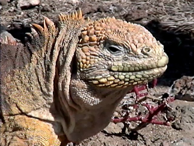
Located far  to the south of Santa Cruz, Floreana island is one of the older islands in the Galapagos Archipelago, and as such, it is a good illustration of  how a volcanic island ages. Unlike the younger western islands, Floreana's volcanoes are in the advanced stages of erosion.  This erosion provides rich soil to the highlands, giving Floreana a much more diverse landscape than its immature counterparts have.

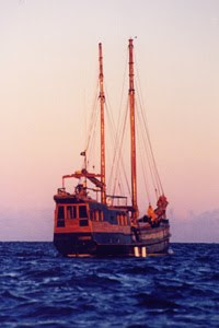
Bahia Post Office Barrel

Floreana has a history of buccaneers, whalers and colonists. In the 18th century, British whalers established the Post Office Barrel to send letters to and from England.  This tradition continues today.  Visitors may drop off unstamped letters and pick up others to carry to destinations around the world.  It took less than two weeks for our postcard to arrive back in the United States.

Today, Floreana has a population of about 170 permanent residents, but in the 1930's, when the island was nearly deserted, it was a place of murder and intrigue. A German dentist, his mistress, a young family and a so-called baroness with three men came to live on the island.  When the baroness and her entourage arrived, they began terrorizing the other inhabitants while planning to build a luxury hotel.  In the course of time, the baroness, two of her lovers and the dentist turned up missing or dead. The deaths created much speculation, but to this day, no one has solved the mystery.


Our adventures to Floreana began with an overnight crossing from Santa Cruz after an early dinner.  Our guide warned us that we would be crossing unprotected waters and that the seas could get a little rough.  That was why we ate in the calm of Puerto Ayora Harbor before the Sulliday got underway.  The first hour or so was fine, but then the boat began to roll across the high swells.  It wasn’t severe, but it was constant.  One by one, we lost our smiles and left to lie down for the duration of the voyage. 

In the morning, everything was back to normal, and after a large breakfast, we headed for a wet landing on the green (olivine crystal) beach of Floreana.  We visited the Bahia post office barrel where we all left postcards and picked up a few to take back.  Then we headed inland to walk through ancient lava tunnels. 

That afternoon we were back on the boat for a snorkeling adventure in the Devil’s Crown.  The Devil’s Crown is an almost completely submerged extinct volcano that erosion has transformed into a semi-circle of jagged peaks jetting out of the water. The crown creates a haven for seabirds such as boobies, pelicans and frigates.

The highlight for us was snorkeling in the center of the crater. While underwater, a torpedo-like sea lion buzzed past me.  It nearly scared me to death until I realized what it was.  Then we floated above a graceful school of golden rays.  We saw colorful angelfish, puffer fish, parrotfish, grunts, eels, rays and a host of other species I couldn’t begin to list. The water is a bit cold and rough with a strong current, but it also provides an easy ride through the crown if you don’t fight it.